


STONEY CREEK 01, Madison County, Indiana
About
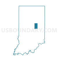
Outline

Summary
| Unique Area Identifier | 578992 |
| Name | STONEY CREEK 01 |
| County | Madison County |
| State | Indiana |
| Area (square miles) | 13.07 |
| Land Area (square miles) | 13.07 |
| Water Area (square miles) | 0.00 |
| % of Land Area | 100.00 |
| % of Water Area | 0.00 |
| Latitude of the Internal Point | 40.08859380 |
| Longtitude of the Internal Point | -85.80873870 |
Maps


Graphs
Select a template below for downloading or customizing gragh for STONEY CREEK 01, Madison County, Indiana


Neighbors
Neighoring Voting District (by Name) Neighboring Voting District on the Map
- ANDERSON CITY 3-5, Madison County, IN
- ANDERSON CITY 4-8, Madison County, IN
- ANDERSON TWP 3, Madison County, IN
- EAST WAYNE, Hamilton County, IN
- JACKSON 01, Madison County, IN
- STONEY CREEK 02, Madison County, IN
- STRAWTOWN, Hamilton County, IN
Top 10 Neighboring County Subdivision (by Population) Neighboring County Subdivision on the Map
- Anderson township, Madison County, IN (56,436)
- Wayne township, Hamilton County, IN (7,886)
- Stony Creek township, Madison County, IN (3,871)
- White River township, Hamilton County, IN (2,486)
- Jackson township, Madison County, IN (1,904)
Top 10 Neighboring Place (by Population) Neighboring Place on the Map
Top 10 Neighboring Unified School District (by Population) Neighboring Unified School District on the Map
- Hamilton Southeastern Schools, IN (90,116)
- Anderson Community School Corporation, IN (71,503)
- Hamilton Heights School Corporation, IN (12,854)
- Frankton-Lapel Community Schools, IN (12,262)
Top 10 Neighboring State Legislative District Lower Chamber (by Population) Neighboring State Legislative District Lower Chamber on the Map
- State House District 29, IN (118,413)
- State House District 37, IN (65,145)
- State House District 35, IN (62,848)
Top 10 Neighboring State Legislative District Upper Chamber (by Population) Neighboring State Legislative District Upper Chamber on the Map
Top 10 Neighboring 111th Congressional District (by Population) Neighboring 111th Congressional District on the Map
Top 10 Neighboring Census Tract (by Population) Neighboring Census Tract on the Map
- Census Tract 1101, Hamilton County, IN (10,372)
- Census Tract 18, Madison County, IN (4,808)
- Census Tract 111, Madison County, IN (3,871)
- Census Tract 16, Madison County, IN (2,633)
- Census Tract 110, Madison County, IN (1,904)